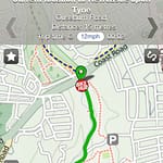
 A new GPS navigation iPhone app called CycleStreets was launched last week. The new iPhone app is free and turns your iPhone into a cyclist’s version of a Garmin GPS navigation system. The new CycleStreets iPhone app is already close to the top of the charts for GPS navigation apps. The app shows the best bike-friendly routes to get from here to there, and displays a map for you to check during your journey. It not only keeps you on bike paths, but also shows you short-cuts that can trim time off your ride.
According to the press release, the app from Bike Hub uses GPS system satellite navigation style routing that has been engineered specifically for cyclists. It keeps you on bike-safe paths and streets, and arranges your route to minimize up-hill cycling. You can even pick if you want the quietest route, the quickest, or a balanced route.
The main features are:
A Cycle Journey Planner which is aware of cycle paths and less congested roads. Of course, the journey planner is part of the core CycleStreets service, and as far as the app is concerned it’s a routing black box. But that’s the point.
You can use the GPS system location to locate yourself on the map, and place a rout endpoint automatically.
You can use the CycleStreets name-finder to look up cities, streets codes and place a journey endpoint there.
Photomap – This is a cycling information tool that maintains a database of geo-tagged photos relevant to the cycling infrastructure. Using the app, you can see photomap photos on the section of the digital map you’re looking at, and you can upload photos to photomap direct from your iPhone.
The cycle routing is done via CycleStreets of Cambridge, a community-based group working on a not-for-profit basis. Cyclestreets uses mathematical graph theory algorithms to quickly work out bicycle-friendly routes. Mapping is provided by OpenStreetMap, the ‘wikipedia of maps’. OpenStreetMap is a community of 300,000 map enthusiasts worldwide who collaborate to produce the most up-to-date maps available. Changes made by members of the OSM community can be available online within hours.
Other interesting features include a “bike shop finder,” a listing of bike-friendly events, and a listing of laws associated with cycling in your area. Customer response to the app has been great so far. The GPS navigation app at the iTunes store shows it has earned a 4 star ranking out of 31 reviews.
Some product shortcomings were discussed in The Guardian Newspaper. One disappointing fact is that the GPS satellite navigation iPhone App for cyclists doesn’t have a little dot tracking your progress. Also, the map doesn’t scroll automatically as you move, which is a bummer. If you want to know exactly where you are located, you need to click the target icon. You’ll get a big round purple doughnut on the screen to show your location, but it disappears quickly. Similarly it won’t tell you how fast you’re going. Overall, the reviews are looking like it’s going to be a hit.